
[mkgmap-dev] Colouring of island not correct
From Christoph Karl pampelmuse at gmx.at on Sat Aug 19 08:37:11 BST 2017
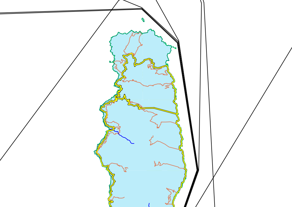
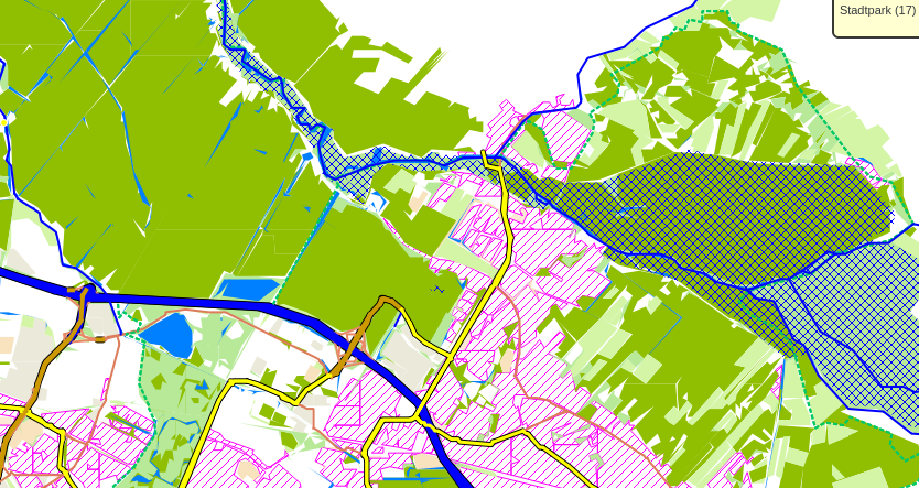
Hi!

I tried to generate a gmapsupp.img with mkgmap.
I have done this with:
/usr/java/jdk1.8.0_144/bin/java -Xmx8G -jar ./mkgmap-r3993/mkgmap.jar --
gmapsupp karten/corse-latest.osm.pbf

But the colouring of the landscape is not correct.
See "corse_wrong_colour.png"

Compared to "bremen_correct.png"

Screenshots are made from qlandkartegt Version 1.8.1.

I also tried to use "--precomp-sea=./karten/sea.zip",
but this just colours the surrounding sea.

Do you have any ideas?

Thank you

Best Regards
Christoph
-------------- next part --------------
A non-text attachment was scrubbed...
Name: corse_wrong_colour.png
Type: image/png
Size: 124545 bytes
Desc: not available
URL: <http://www.mkgmap.org.uk/pipermail/mkgmap-dev/attachments/20170819/33ccef4d/attachment-0002.png>
-------------- next part --------------
A non-text attachment was scrubbed...
Name: bremen_correct.png
Type: image/png
Size: 255156 bytes
Desc: not available
URL: <http://www.mkgmap.org.uk/pipermail/mkgmap-dev/attachments/20170819/33ccef4d/attachment-0003.png>
- Previous message: [mkgmap-dev] How to identify beginning and end of a route?
- Next message: [mkgmap-dev] Colouring of island not correct
- Messages sorted by: [ date ] [ thread ] [ subject ] [ author ]
More information about the mkgmap-dev mailing list