
[mkgmap-dev] Artifacts in final map (.MP -> .IMG conversion)
From Andrzej Popowski popej at poczta.onet.pl on Fri Feb 8 22:07:47 GMT 2019
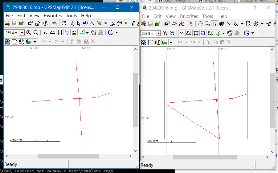
Hi Gerd,

I think I have written about these problems some time ago. There is
similar problem for polylines, which contains multiple DATA statement.
Each DATA is a separate line in mp format, but mkgmap connects them
together, which is wrong:
SEVERE (PolishMapDataSource): 29483016.mp: Line null has multiple Data
lines - concatenating the points

See attached picture with source mp and compiled img in GPSMapEdit.

--
Best regards,
Andrzej
-------------- next part --------------
A non-text attachment was scrubbed...
Name: mdata.png
Type: image/png
Size: 20782 bytes
Desc: not available
URL: <http://www.mkgmap.org.uk/pipermail/mkgmap-dev/attachments/20190208/1ca5b3ad/attachment-0001.png>
- Previous message: [mkgmap-dev] Artifacts in final map (.MP -> .IMG conversion)
- Next message: [mkgmap-dev] Artifacts in final map (.MP -> .IMG conversion)
- Messages sorted by: [ date ] [ thread ] [ subject ] [ author ]
More information about the mkgmap-dev mailing list