
[mkgmap-dev] Squaring off of land outlines
From Mike Baggaley mike at tvage.co.uk on Mon Jan 27 00:43:17 GMT 2020
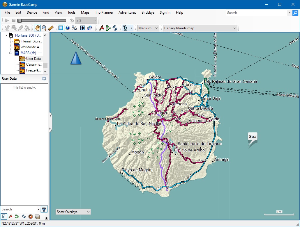
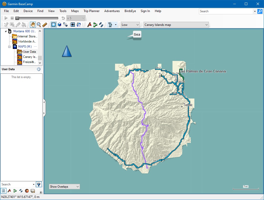
Hello,

I am getting squaring off of the outline between land and sea at low zoom
levels (less than 16) - see attached BaseCamp images of Gran Canaria at
resolution 16 and at resolution 14 displayed at the same size. Obviously
some reduction in accuracy is expected at lower zoom level, but not these
artefacts. I'm not sure when this started happening but believe it was some
time ago. I can't seem to find the old releases to try previous versions,
http://svn.mkgmap.org.uk/mkgmap/releases/ just shows me an empty folder. Can
you point me to the correct download folder that contains the previous jar
files, and/or let me know if this is a known problem, and if so whether
there is a workaround?

Thanks,
Mike
-------------- next part --------------
A non-text attachment was scrubbed...
Name: res 16.jpg
Type: image/jpeg
Size: 221674 bytes
Desc: not available
URL: <http://www.mkgmap.org.uk/pipermail/mkgmap-dev/attachments/20200127/3a477ac7/attachment-0002.jpg>
-------------- next part --------------
A non-text attachment was scrubbed...
Name: res 14.jpg
Type: image/jpeg
Size: 181674 bytes
Desc: not available
URL: <http://www.mkgmap.org.uk/pipermail/mkgmap-dev/attachments/20200127/3a477ac7/attachment-0003.jpg>
- Previous message: [mkgmap-dev] Commit r4431: Improve typ file mapnik.txt
- Next message: [mkgmap-dev] Squaring off of land outlines
- Messages sorted by: [ date ] [ thread ] [ subject ] [ author ]
More information about the mkgmap-dev mailing list