
[mkgmap-dev] Hide tunnels and other features in basecamp 3D mode
From Gerd Petermann gpetermann_muenchen at hotmail.com on Mon Jan 14 06:31:07 GMT 2019
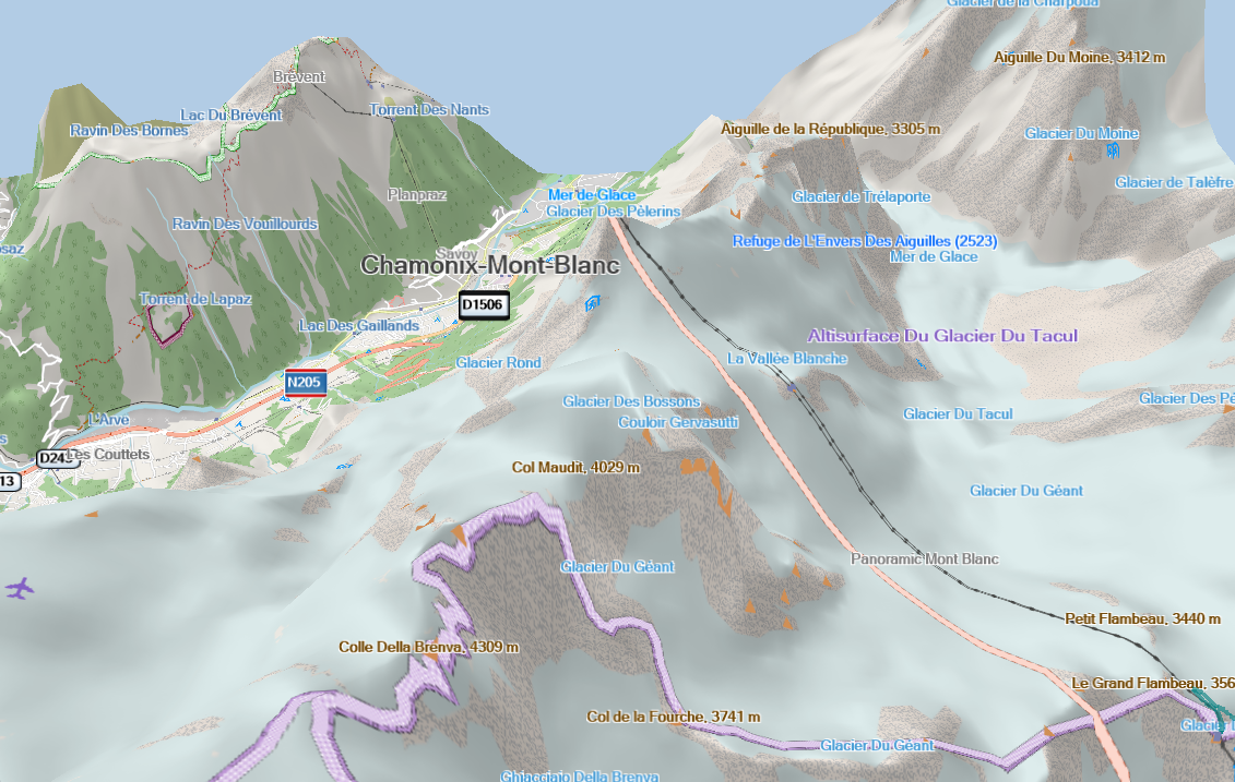
Hi Joris,

would be interesting to know what original Garmin (non-NT) maps show in this situation.  I did not find a tunnel in the Adria Topo Demo map but I did not invest much time for the search. See also
http://gis.19327.n8.nabble.com/what-do-the-0x4a-polygon-in-the-mean-tp5910134p5910183.html

I am not aware of any flag in the *.img format that could be used to mark a tunnel as such, but maybe it exists and nobody found it until now.

Gerd

________________________________________
Von: mkgmap-dev <mkgmap-dev-bounces at lists.mkgmap.org.uk> im Auftrag von Joris Bo <jorisbo at hotmail.com>
Gesendet: Sonntag, 13. Januar 2019 09:57
An: Development list for mkgmap
Betreff: [mkgmap-dev] Hide tunnels and other features in basecamp 3D mode

Hello

I added the DEM / Hillshading to my maps. If I set basecamp to show in 3d you get very nice results ! Thx for all the work done there.
Is there an option to tag certain elements to be hidden in (basecamp) 3D modus?
For example the Mont Blanc Tunnel goes straight up to the to the top 😊

[cid:image001.png at 01D4AB26.4D264E50]
-------------- next part --------------
A non-text attachment was scrubbed...
Name: image001.png
Type: image/png
Size: 916473 bytes
Desc: image001.png
URL: <http://www.mkgmap.org.uk/pipermail/mkgmap-dev/attachments/20190114/90505b69/attachment-0001.png>
- Previous message: [mkgmap-dev] Hide tunnels and other features in basecamp 3D mode
- Next message: [mkgmap-dev] default style improvements / upated typ-file
- Messages sorted by: [ date ] [ thread ] [ subject ] [ author ]
More information about the mkgmap-dev mailing list