
[mkgmap-dev] one mistake less in DEM
From Frank Stinner frank.stinner at leipzig.de on Tue Jan 9 10:40:33 GMT 2018
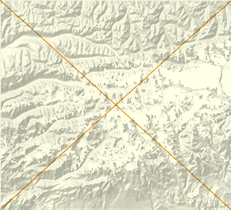
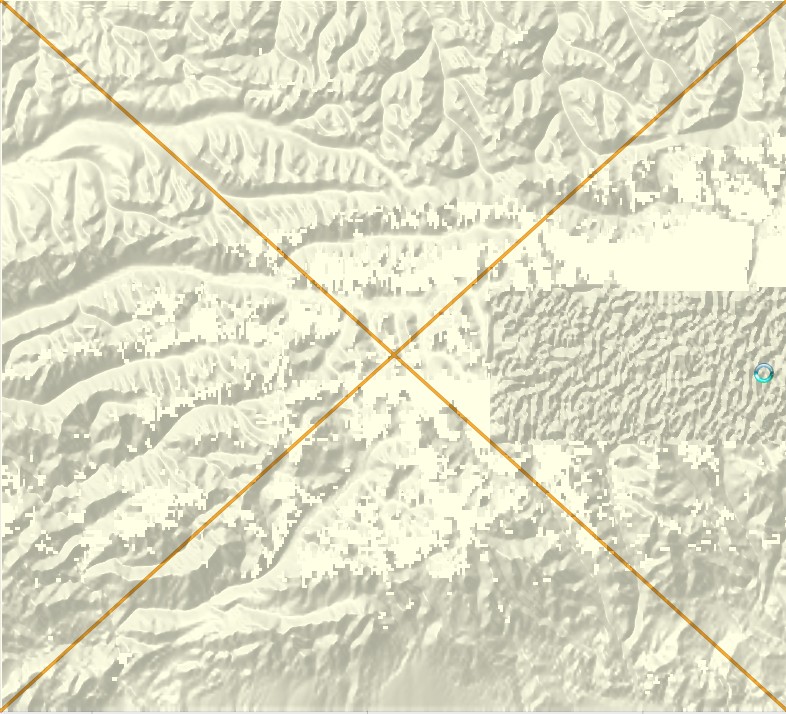
Hi,

there is a new BuildDEMFile-version with a rectified encoder. This should
help on maps with strong changes in height.

Example:
East 79,335° / North 42,554°, PointDistance 55000 -> 0,004610°


Hi Gerd,
there seems to be a limitation for my variable "sumH" for the calculation
of hunit. Perhaps garmin use only a 2-byte-var. I have included in
CodingTypeStd.addValue() after "SumH += dh;":

if (SumH + unitdelta + 1 >= 0xFFFF)
   SumH -= 0x10000;

I have no idea, why not "if (SumH + unitdelta > 0xFFFF)" or so.
I have done the same with CodingTypePlateauFollowerNotZero.AddValue() and
CodingTypePlateauFollowerZero.AddValue().


Frank
-------------- next part --------------
An HTML attachment was scrubbed...
URL: <http://www.mkgmap.org.uk/pipermail/mkgmap-dev/attachments/20180109/6a0df05e/attachment-0001.html>
-------------- next part --------------
A non-text attachment was scrubbed...
Name: new.jpg
Type: image/jpeg
Size: 157862 bytes
Desc: not available
URL: <http://www.mkgmap.org.uk/pipermail/mkgmap-dev/attachments/20180109/6a0df05e/attachment-0002.jpg>
-------------- next part --------------
A non-text attachment was scrubbed...
Name: old.jpg
Type: image/jpeg
Size: 162446 bytes
Desc: not available
URL: <http://www.mkgmap.org.uk/pipermail/mkgmap-dev/attachments/20180109/6a0df05e/attachment-0003.jpg>
- Previous message: [mkgmap-dev] Performance with zipped hgt files
- Next message: [mkgmap-dev] one mistake less in DEM
- Messages sorted by: [ date ] [ thread ] [ subject ] [ author ]
More information about the mkgmap-dev mailing list