
[mkgmap-dev] DEM-file generation from geo-tiff sources ?
From Frank Stinner frank.stinner at leipzig.de on Tue Jan 2 14:58:10 GMT 2018
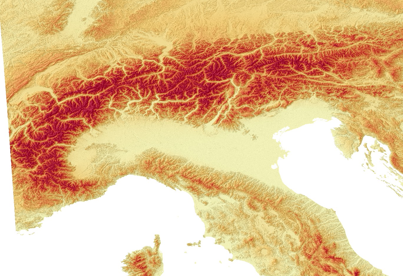
For my opinion your data sources are very interesting. This is a short
look to the alps, the tile E40N20 from https://land.copernicus.eu/.

There seem's to be a little problem at the near of some coastlines, but we
have on the other hand a high resolution of 25m. I belive, a bigger
problem is the coordinate reference system. Copernicus data have
EPSG:3035, garmin use EPSG:4326.

It would be fine, if mkgmap could be read geotiffs and calculate with
different coordinate reference systems. This would perhaps collect the
interpolation for changing the coordinate reference system and for the
garmin map. On the other hand: this is a lot of mathematical stuff. I'm
not a java hacker and i don't know, if there are usable geografic librarys
for this work.

At the moment we have to translate the tiffs from EPSG:3035 to EPSG:4326,
then the segmentation in 1°x1° tiffs an at last the conversion to hgt
files. This should not be a very great problem with gdal-tools or so, but
it is additional work.


Frank
-------------- next part --------------
An HTML attachment was scrubbed...
URL: <http://www.mkgmap.org.uk/pipermail/mkgmap-dev/attachments/20180102/b5d42b3a/attachment-0001.html>
-------------- next part --------------
A non-text attachment was scrubbed...
Name: Alpen.jpg
Type: image/jpeg
Size: 512484 bytes
Desc: not available
URL: <http://www.mkgmap.org.uk/pipermail/mkgmap-dev/attachments/20180102/b5d42b3a/attachment-0001.jpg>
- Previous message: [mkgmap-dev] DEM-file generation from geo-tiff sources ?
- Next message: [mkgmap-dev] DEM-file generation from geo-tiff sources ?
- Messages sorted by: [ date ] [ thread ] [ subject ] [ author ]
More information about the mkgmap-dev mailing list