
[mkgmap-dev] Object labels and zoom levels
From Carlos Dávila cdavilam at orangecorreo.es on Thu Jun 18 17:06:26 BST 2015
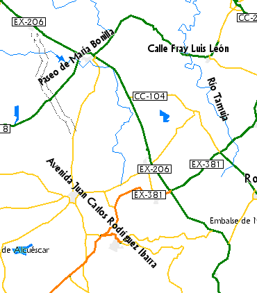
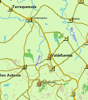
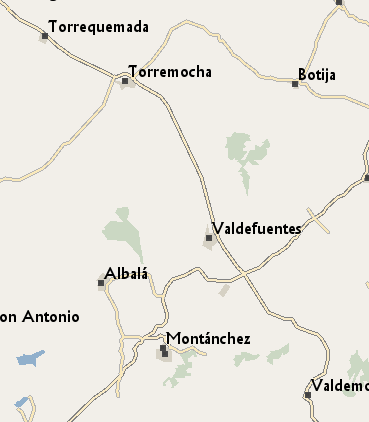
I have the following problem in my maps: at low zoom levels MapSource
renders the name of some highway=* objects in places such as villages or
cities, but it doesn't show the names of the place=* object. Showing the
name of a street in a village you don't know which one is doesn't seem
to be very useful. Is there a way to control zoom level at which labels
are rendered, independently from the resolution of the named object in
the style? Is it possible to give precedence to place=* labels instead
of highway=* ones?

See attached screenshots of the same area at 5 km zoom level and high
detail level from my maps, openfiestmap and openmtbmap to note the
difference.
-------------- next part --------------
A non-text attachment was scrubbed...
Name: labels_alternativaslibres.png
Type: image/png
Size: 30457 bytes
Desc: not available
URL: <http://www.mkgmap.org.uk/pipermail/mkgmap-dev/attachments/20150618/5f927454/attachment-0003.png>
-------------- next part --------------
A non-text attachment was scrubbed...
Name: labels_openfiestmap.png
Type: image/png
Size: 32089 bytes
Desc: not available
URL: <http://www.mkgmap.org.uk/pipermail/mkgmap-dev/attachments/20150618/5f927454/attachment-0004.png>
-------------- next part --------------
A non-text attachment was scrubbed...
Name: labels_openmtbmap.png
Type: image/png
Size: 18691 bytes
Desc: not available
URL: <http://www.mkgmap.org.uk/pipermail/mkgmap-dev/attachments/20150618/5f927454/attachment-0005.png>
- Previous message: [mkgmap-dev] severe style problem
- Next message: [mkgmap-dev] Object labels and zoom levels
- Messages sorted by: [ date ] [ thread ] [ subject ] [ author ]
More information about the mkgmap-dev mailing list