
[mkgmap-dev] DEM bug at 50°N
From Bernhard Hiller bhil at gmx.de on Tue Apr 10 12:30:49 BST 2018
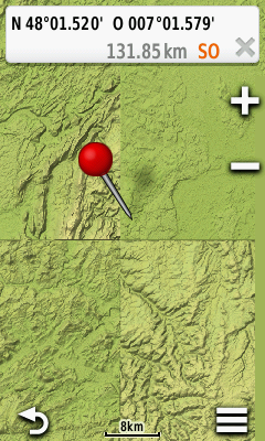
Hi Gerd,

I created the map again, but now including L31-N31 zipped DEM files
(because the far west end of my map is just west of 6E, which was not
included before, but did not produce warn messages either).

Further analysis with this new map shows that the same DEM tile of 1x1°
gets repeated (it is different from the tile in the previous map).
That can be clearly seen in areas without osm data, i.e. where the map
shows relief only. The screen shot for 48N 7E does not differ from 48N
6E or 49N 6E.
I hope this helps to narrow down the location of the bug.

Kind regards,
Bernhard

Am 10.04.2018 um 11:51 schrieb Gerd Petermann:
> Hi Bernhard,
>
> okay, I'll try to reproduce the problem later. I always use --write-kml to produce a kml file which can be loaded in many tools
> like JOSM (opendata plugin is needed)
>
> Gerd
>
> ________________________________________
> Von: mkgmap-dev <mkgmap-dev-bounces at lists.mkgmap.org.uk> im Auftrag von Bernhard Hiller <bhil at gmx.de>
> Gesendet: Dienstag, 10. April 2018 11:28:14
> An: mkgmap-dev at lists.mkgmap.org.uk
> Betreff: Re: [mkgmap-dev] DEM bug at 50°N
>
> Hi Gerd,
>
> an example of a tile with the bug is 43100115, but many more tiles show
> the bug, like 43100096 along Lech river near Landsberg.
>
> In contrast, 43100105 looks OK south of 48°N (south part of Freiburg
> town, Schauinsland mountain), but wrong in the northern suburbs of
> Freiburg.
> That is, a tile can have both correct and defective DEM values.
> 48N is also the border between L32 and M32 zip files with DEM data.
>
> My current impression is that everything north of 48° is wrong, take
> also a look at the relief at the Oder river near the German-Polish
> border. Places in southern Bavaria and Baden-Württemberg look OK.
>
> Do we have some software for visualising where to find which tile?
> QLandkarte GT shows tile borders, but no information re its number.
>
> Kind regards,
> Bernhard
>
> Am 09.04.2018 um 07:26 schrieb Gerd Petermann:
>> Hi Bernhard,
>> might be a special case.
>> Please post the split-file (areas.list) and the tile number that causes problems.
>>
>> Gerd
>>
>> ________________________________________
>> Von: mkgmap-dev <mkgmap-dev-bounces at lists.mkgmap.org.uk> im Auftrag von Bernhard Hiller <bhil at gmx.de>
>> Gesendet: Sonntag, 8. April 2018 20:40:23
>> An: mkgmap-dev at lists.mkgmap.org.uk
>> Betreff: [mkgmap-dev] DEM bug at 50°N
>>
>> According to the DEM in the map, the Rhine river some 3 km away from my
>> home is at an elevation of some 2600 m asl. I do not live in the Swiss
>> alps, but some 50km west of Frankfurt, just north of 50°N... The correct
>> elevation is about 80m.
>> Near Bingen (just south of 50°N), the Rhine is at an elevation of ~500m,
>> somewhere between Assmannshausen and Lorch it ascends suddenly and very
>> steeply to almost 3000m. In Cologne still at 500 m asl.
>> South of 48°N, the data seem OK; but in the north, I did not find
>> reasonable values - the Elbe in Hamburg above 1000m asl.
>>
>> I exclude a problem in the DEM data: before creating the map of Germany
>> and Czechia, I tested with Hessen only. And then, the DEM values looked
>> reasonable.
>>
>> I use mkgmap 4143. The command includes parameters for DEM:
>>        --dem-polyês.poly ^
>>        --dem=PATH% ^
>>        --dem-dists314,4000,6000,8000,10000,15000,20000,30000 ^
>> areas.poly were created by splitter in the step before,
>> SET
>> DEMPATH=aps\Development\SRTM\L32.zip,E:\Maps\Development\SRTM\M32.zip,E:\Maps\Development\SRTM\N32.zip,E:\Maps\Development\SRTM\L33.zip,E:\Maps\Development\SRTM\M33.zip,E:\Maps\Development\SRTM\N33.zip
>> contains DEM data from
>> http://www.viewfinderpanoramas.org/Coverage%20map%20viewfinderpanoramas_org3.htm
>> (while testing with Hessen, %DEMPATH% was
>> E:\Maps\Development\SRTM\M32.zip only which contains data from N48E006
>> to N51E011).
>>
>> Or is it a matter of file size? The largest *.img file has 131256kB.
>>
>> Kind regards,
>> Bernhard
>> _______________________________________________
>> mkgmap-dev mailing list
>> mkgmap-dev at lists.mkgmap.org.uk
>> http://www.mkgmap.org.uk/mailman/listinfo/mkgmap-dev
>>
>

-------------- next part --------------
A non-text attachment was scrubbed...
Name: 607.bmp
Type: image/bmp
Size: 288054 bytes
Desc: not available
URL: <http://www.mkgmap.org.uk/pipermail/mkgmap-dev/attachments/20180410/19e43438/attachment-0001.bmp>
- Previous message: [mkgmap-dev] DEM bug at 50°N
- Next message: [mkgmap-dev] DEM bug at 50°N
- Messages sorted by: [ date ] [ thread ] [ subject ] [ author ]
More information about the mkgmap-dev mailing list