
[mkgmap-dev] map detects barriers like gate as passable by motor vehicle when it is only restricted to pedestrians
From maning sambale emmanuel.sambale at gmail.com on Thu Mar 18 06:06:12 GMT 2010
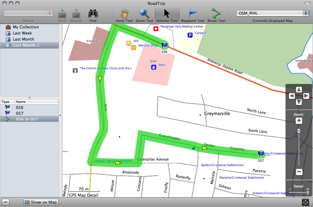
Hi,

Just want to share a report from one of the gps map users.

In this example, the gate blocks any motor vehicle from going to
grasshopper street and spider intersection, and to crispina. This gate
is only passable by pedestrian.
If the destination is somewhere crispina, the correct route should be
through caterpillar avenue and then left on spider street.

Here is a sample route with gate as barrier:
 http://www.openstreetmap.org/?lat=14.44558&lon=120.985888&zoom=18&layers=B000FTFT

The calculated route in roadtrip is here:
http://farm5.static.flickr.com/4059/4441971869_397ce8bd84_o.jpg


I'm inclined to think that this is a data problem (the gate should
explicitly define that is only usefule for pedestrians).  I can't find
the correct tagging for this one at the moment.  If such tag exist, is
it supported by mkgmap?


--
cheers,
maning
------------------------------------------------------
"Freedom is still the most radical idea of all" -N.Branden
wiki: http://esambale.wikispaces.com/
blog: http://epsg4253.wordpress.com/
------------------------------------------------------
- Previous message: [mkgmap-dev] Commit: r1607: I have found that some multipolygons use nested inner polygons.
- Next message: [mkgmap-dev] map detects barriers like gate as passable by motor vehicle when it is only restricted to pedestrians
- Messages sorted by: [ date ] [ thread ] [ subject ] [ author ]
More information about the mkgmap-dev mailing list